Directions: The trailhead is on an FSR with active logging 7 days a week. A radio is recommended, and you must be cautious. You will start by heading down Menzies Road, just north of Campbell River. The road will pass an industrial facility and bridge, from this bridge, 3.1km down the road, you will reach a long bridge with pull outs on either side. Park here, you’ll need to leave room for cars to pull out and yield to the other side. The trail is on the initial approach to the bridge, on the edge of the pullout.
Trail: This hike brings you on a journey through a series of waterfalls. It is set in a mystical mature rain forest, with huge prominent hemlock trees. The trail is muddy much of the year, so boots are recommended. You will gradually accumulate elevation with a few shorter steep sections where ropes are set up to help.
The trail can be rough, and slippery at points. It is moderately challenging at 7.1km and about two hours for a fit person. It is possible to do it in two, but I took close to four. I’m sure you will want to take time to bask once you enter this serene environment. I almost wish I had stayed longer. The constant sound of water mixed with the life-filled lush forest keeps you hooked. As you head up the out-and-back trail you will notice it is easy to stay on. There are no offshoots and the trail is open, surrounded by lush vegetation, marshes, and towering trees.
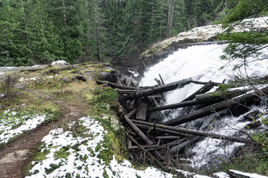
The first waterfall, known as Trout Falls or Trout Creek Falls comes up pretty fast. It is measured 30ft high. There are “hangout spots” at the top and bottom to relax and check out its glory. From here you will come across a series of waterfalls, some with more of those hangout spots, until you reach the falls I have dubbed “The Little Crack”. After taking in some exceptional geological features and capturing photos, you will take a turn and head into the forest.
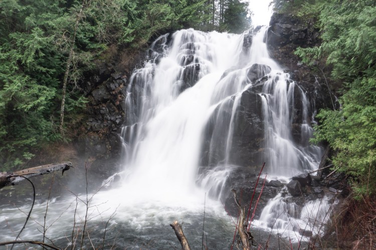
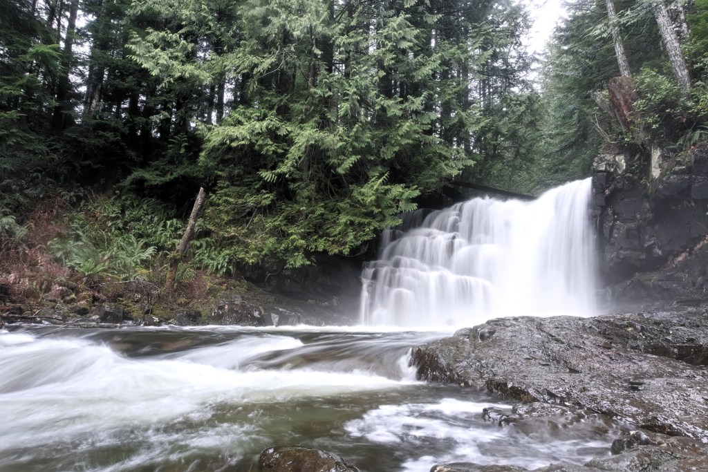
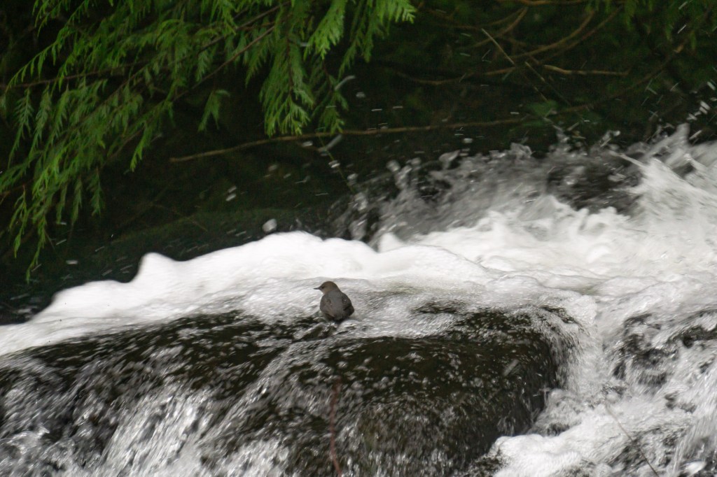
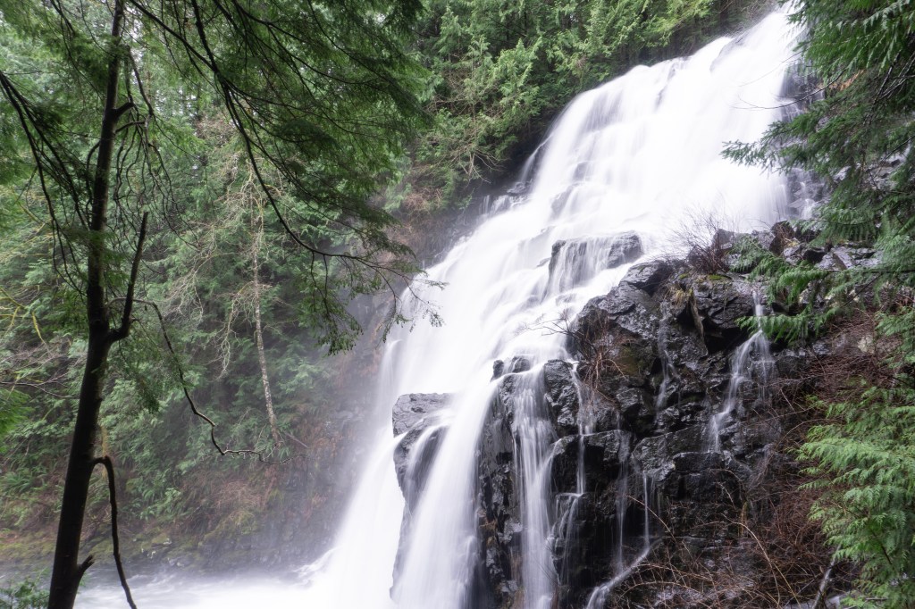
As I hiked away, I couldn’t help but think about how many waterfalls we could be missing along side the river. Then just as your lost again in the shadow of the giants and distant sounds of the creek, out in the distance you catch a glimpse. A roaring 60ft plateauing waterfall standing across a marshy valley, this feeling had me literally jumping with joy. From here, the trail winds around and presents you with many viewing options of the falls. After a misty shower at its base, a short steep hike take you to a balcony-like formation it’s top. From this balcony, I had a bird come to check us out from the forest. He looked at me, sang, then proceeded to the middle of the falls to hang off the edge and bath himself for several minutes. It was a precious moment, which seemed to be a theme here.
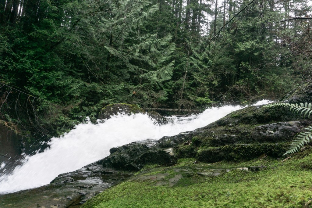
Shortly up the trail, you will reach another magnificent fall with the very obvious name of “The Big Crack”. From my point of view, it’s the big brother of “The Little Crack”. From some angles, it resembles Englishman Falls, only you can easily walk directly us to its ledge and beneath it. The variety and awesomeness of waterfalls on this trail left a powerful impression on the spirit; I was highly impressed.
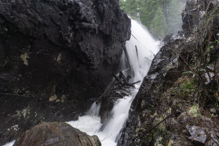
The Big Crack was a perfect way to end the hike. With the power of Mohun Creek carving straight through the hard rock. Just like its left it’s mark on the landscape it has left its mark in my mind; as a wondrous, magical experience. The trail continues on to Mary Lake FSR but this is the turnaround point for us.
Trout Creek and The Past: Until the seventies, the Creek was named Trout for it’s impressive sea-run trout and salmon run. The creek was historically used in the past by the Wei Wai Kum and We Wai Kai peoples as an excellent food source. Later by settlers, and then by modern peoples as a popular sports fishing spot. Today, at the time of writing this, fishing has been banned between the first bridge and Morton Lake. This is because of the quick and massive decline in fish populations in the modern day.
The surrounding area has been a high traffic area for thousands of years, first by the First Nations, then the resource industry and the adventurous. The area indeed has had a long, fruitful history. Today, the area is known as Snowden Demonstration Forest. The logging industry, but also mountain bikers, hikers and those seeking adventure, use it and enjoy it. It holds many hidden gems to stumble upon and is an incredibly beautiful landscape.
The creek was renamed Mohun Creek for an English surveyor known as Charles, who moved to BC in 1863 to work. By government records, he was known as Edward, or C.E. Mohun. The government commissioned him to survey reservation borders for Vancouver Island and the coastal area in 1876. He is mentioned in the 1877 Report to Chief Commissioner of Lands and Works as being in the area surrounding the creek during that year. He is noted as surveying the “Salmon River Valley” Area and sending back a positive report for settlement, sparking a survey for the subdividing of areas “suitable for cultivation”. To find more information, look in the BC Sessional Papers for the Indian Commission in the years 1876, 1877 and 1878, which contain many of the administrative details surrounding this exhibition. It is quite fun to look through Mr.Mohun and associates receipts.
Resources:
https://gohiking.ca/mohun-creek/#:~:text=Mohun%20Creek%20flows%20from%20Mohun,Tap%20to%20unmute
REPORT OF THE CHIEF COMMISSIONER OF LANDS AND WORKS OF THE PROVINCE OF BRITISH COLUMBIA FOR THE FISCAL YEAR ENDING THIRTY-FIRST DECEMBER 1877.
Freshwater Fishing Regulation Synopsis
https://archive.org/details/mapofprovinceofb00mohu
